The Fire Wraith (pass 3)

Another incremental improvement to a Godot 4.7 photomode render of the Fire Wraith scene out of The Half Elven Orphan. I like grounde settings so the tower is an amalgamation of historical ruins from the period 850-1050. Planet curvature, moonlight etc all derived from the moon and the star system also modelled in Godot. The Wraith herself is Makehuman and Blender, with a historical kirtle-and-chemise outfit. The sword-form pose is from the I.33 manuscript.
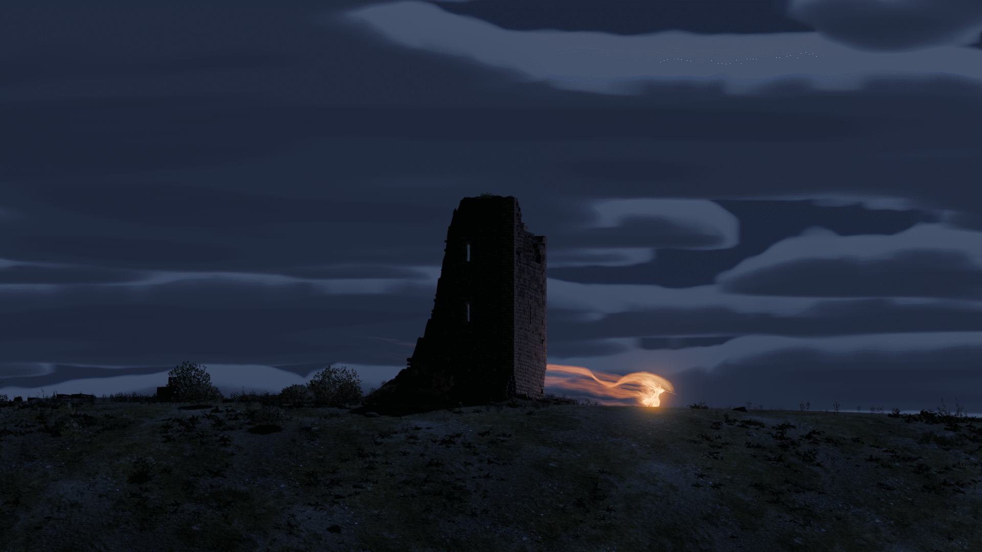
I’m doing this because I’m finding it’s very hard for an author to generate promotional material. Walls of text don’t draw people in to a post, pictures and video does. So, this is my solution. Get assets into Godot, make compositions and make stills or animations with them. I’ve used Claude Code to help me make the tools for this (I would never have had the time for it otherwise), but the creative input is my own or the artists I hire. Besides the widespread irrational hatred for generative AI, it’s also just very poor at making the image you want. I’ve experimented with it, but I’d say generating 10,000 images per usable one is about the hit rate. It’s a waste of time, quite aside from the fact that you never know how closely what it flops out is plagiarising someone’s work.

I have more ideas what I might want to do with these 3D assets in the longer term, but I’m a very long way from getting any of that done.
Temptations while mapping

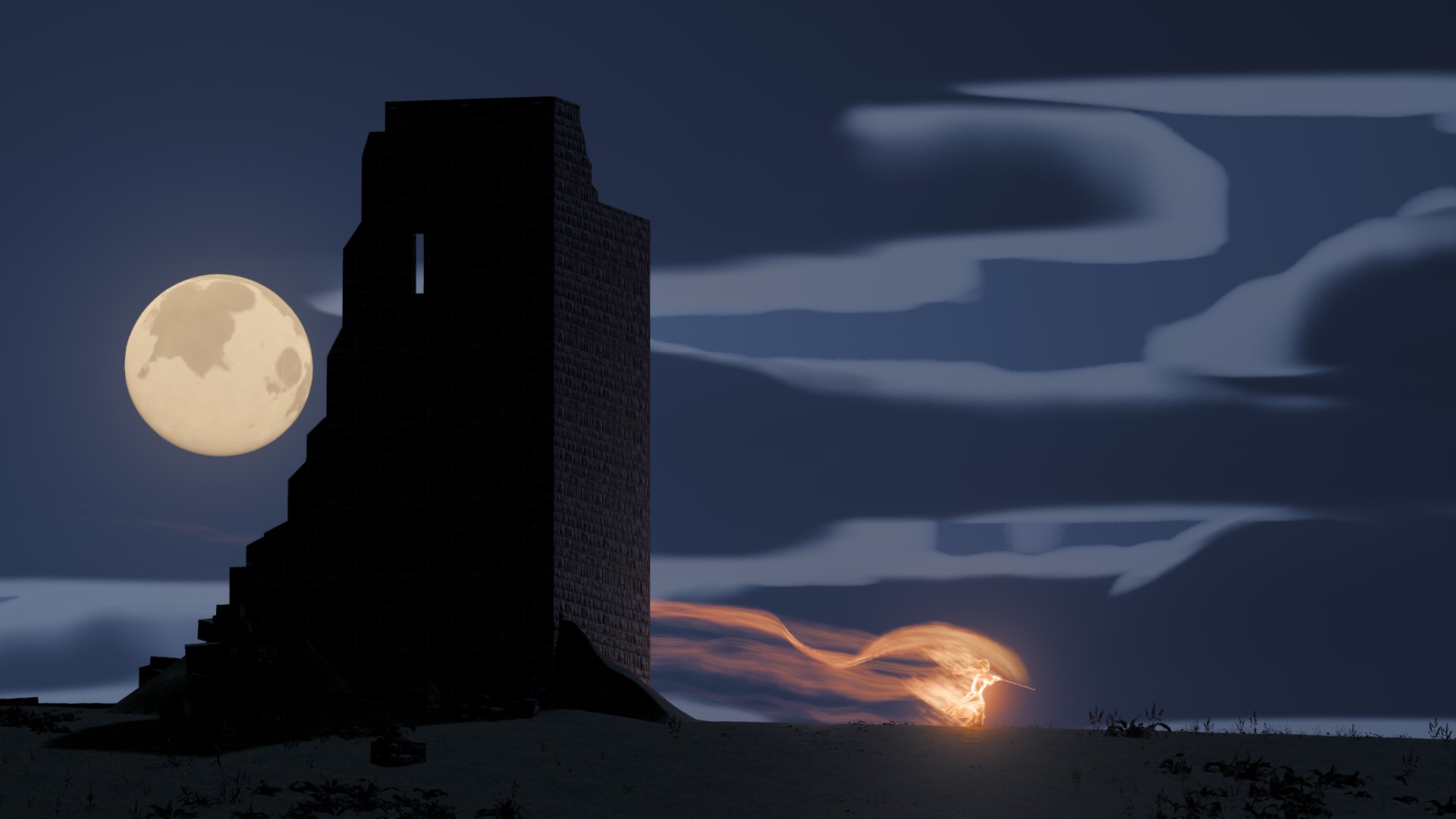
I couldn’t resist the urge to use Godot, Blender, Claude Code and my shiny new OGIS height maps together with my written text to try and generate some 3D scenes. Getting this to where I want it is going to be a long process, but I do have something to show already. There’s a scene in my first book (out now) that gives Maiden Tower, a ruined keep, its name. Since I’m building places in 3D and I have pretty good idea what I want the place and the surrounding geography to look like, I decided I’d try generating it in order to make promotional screenshots.

Maiden's Tower, near Thetwick with a Fire Wraith dancing around its base
Maiden’s Tower, near Thetwick with a Fire Wraith dancing around its base

Those who have read the book should recognise this scene (The Fire Wraith). This is a Godot 4 level, with the geography informed by the OGIS map and the moon position informed by the system view. I did have to fudge the geography and add hills of specific heights in specific spots in order to make everything work with the descriptions in the book, but it’s a scene that can exist in Vatan without having to fudge the possible reality. That sort of result, things that work systemically, are always nice.

This was the second pass, obviously it’s going to need more detail, so it’s an ongoing project. I’m going to use this approach with the Droopy model as well. For promotional purposes I often find myself limited by the fact that writing doesn’t produce much eyecandy. By having my world (partially) described in Godot, I’m hoping it’s going to be far easier to generate promotional screenshots for use on social media and the like. I love Daria’s art but she both doesn’t have the time and I could never afford enough art to promote as much as I need to to sell any books. If sales go up, I’ll happily contract more artists, but even then, these 3D tools will help them create imagery that is plausible.

More Mapping

So a little update on my efforts to get my Wonderdraft-drawn maps projected onto a 3d Globe in Godot 4. I’m working from I think five wonderdraft maps and some edits of them. I’ve used Claude Code to project them onto a Globe in Godot 4.

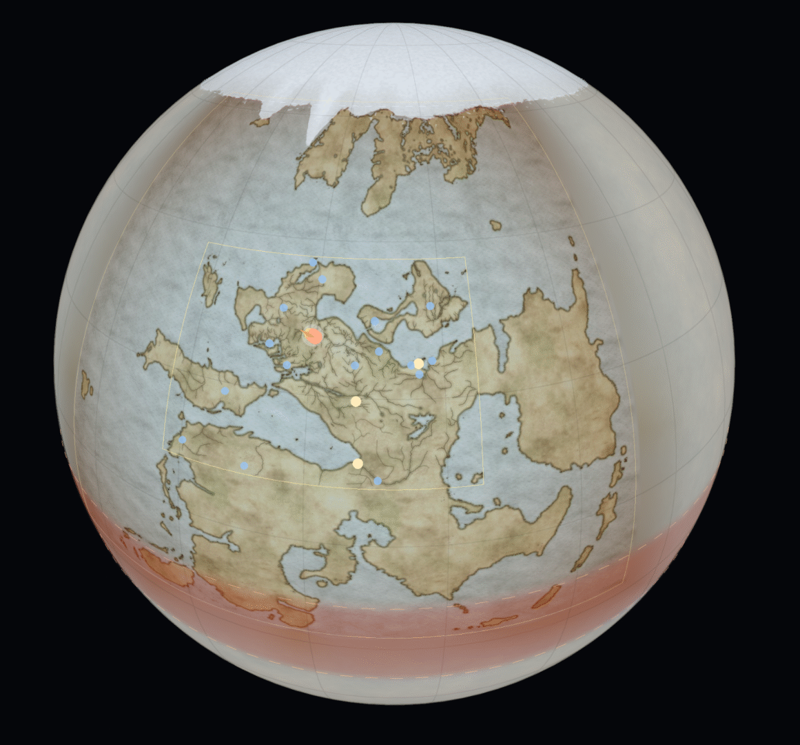
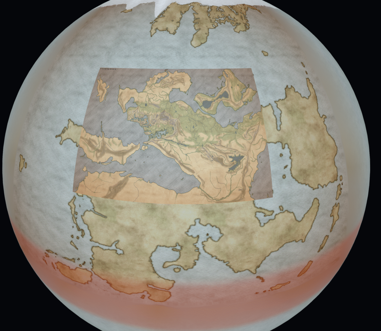
Vatan Globe, view of Taldyr with projected maps
The globe, with a view that gives you an idea of some of the projected maps.

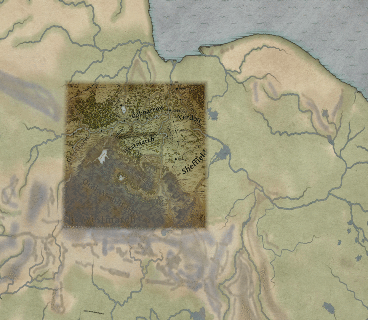
Then more zoom below, so that the Thetwick environs map becomes visible too. You can find the map here if you want to see the original.

Projection of the Thetwick and environs map onto a globe.
The Thetwick environs map (available on this website) projected over the rougher maps onto the globe.

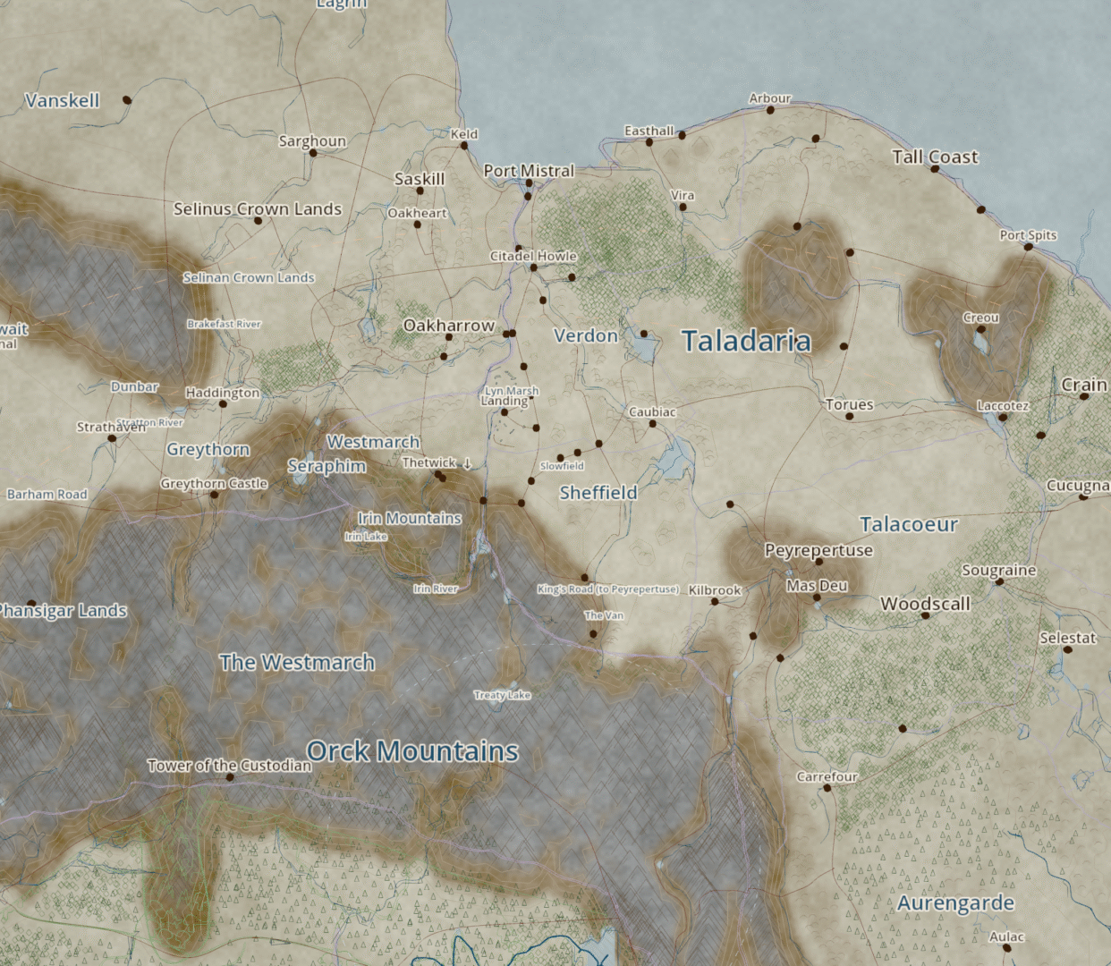
I then analysed all the projected layers to automatically trace them into an OGIS format that is then displayed on the globe again.

OGIS Map version of the Thetwick area.
This is what the extracted data looks like when I display the OGIS result on the globe.

I’m going to take it further as I need it of course. I’ve got some tools now, to draw hills, roads, rivers and settlements, so it should be much easier to map my writing from now on. Quite pleased with these steps, if I do say so myself.

Wormhole Layout in Godot 4

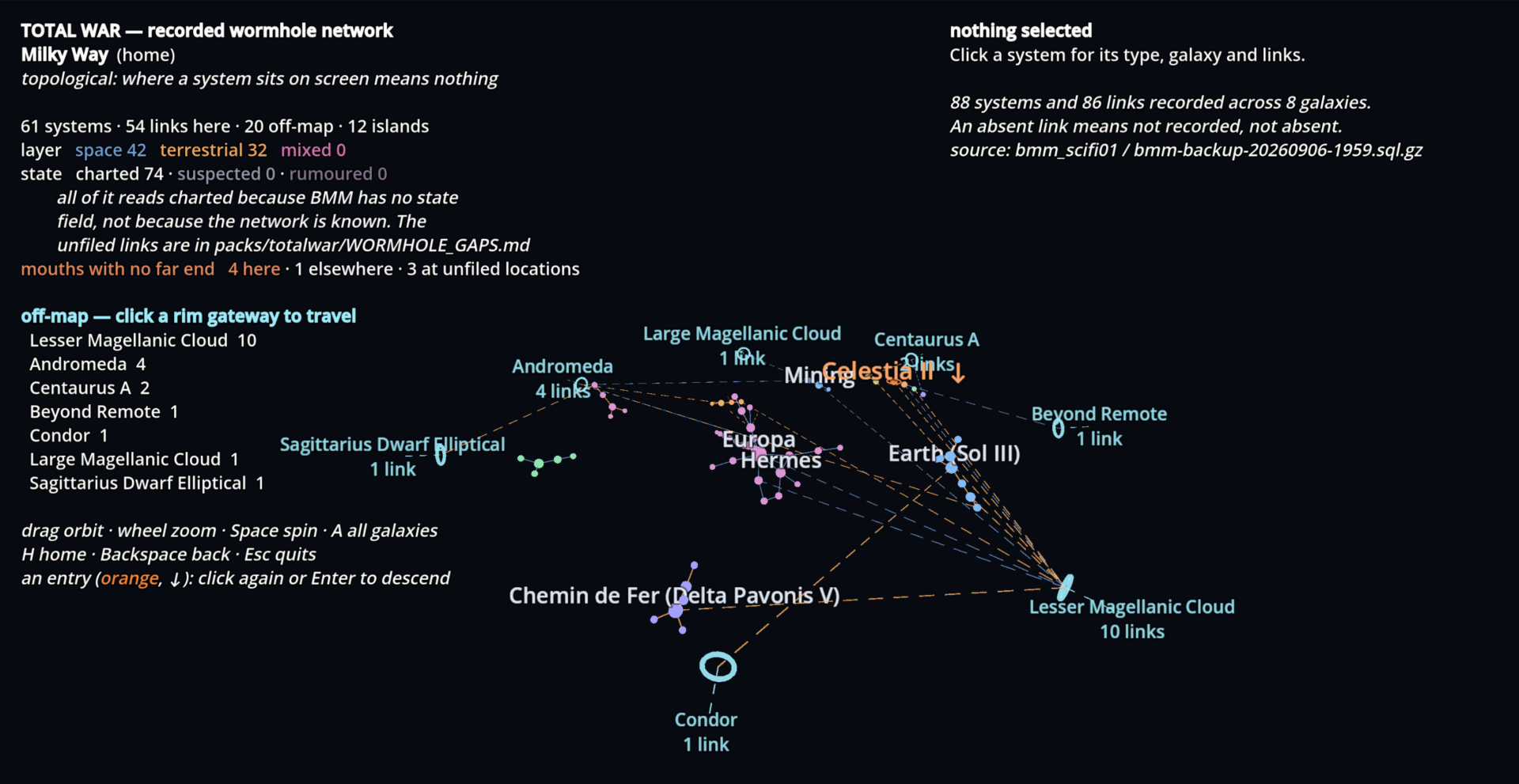
Parallelto my project to get Tales of Vatan worldbuilding data into Godot 4, I’ve been doing the same with my Total War setting. Top level here is a map of the wormhole network. Goals are more or less the same as for Vatan, with the addition of Wormholes and a means of working out travel times through wormholes and systems.

Below is the top-level overview, the wormhole network in the Milky Way. Early days, but I’ve wanted this kind of graphical representation for a very long time. I never had the time to teach myself proper Godot, but with Claude Code assistance it’s far less time consuming.

Vatan in Godot 4

I’ve long wanted to get a lot of the data from my settings into a 3D engine. Ideally I’d eventually like to edit maps directly on a globe, including things like defining elevation roads, rivers, towns and whatnot. When I grow up, who knows, I may have a bunch of the work done for a game already too.

I’ve chosen to work in Godot 4, it’s open source and I’ve supported it in the past. Guess the idea of leaving the IP of the basis for you 3D program in the hands of someone else just never seemed like a good idea to me.

Since I have never had time to actually sit down and learn everything I needed to build something in an engine like Godot, Claude Code is somehting of a godsend for me. I know what I want and how I want it, and I do have some experience programming. I’m finding that with that basis, getting Claude to do the drudge work is saving me massive amounts of time.

Below is the first thing that I might call a result. My master map of Vatan projected onto a globe of the dimensions I defined for the planet. Vatan is very hot round the equator and very cold at the poles. It’s far larger than earth, but it’s core is less dense than Earth’s Iron core, so gravity is about the same. There’s about an Earth’s worth of habitable climate in each of the hemispheres.

I’m going to put the moon in, and simulate rotation which will give me time differences and all sorts of other detailed goodies.

Someday I’d like to release a RPG setting for Tales of Vatan, and to me personally a tool that will tell you when sunrise and sunset is something that would make a setting feel far more alive. To me, using these kinds of tools to get the physics of a world right makes it much more alive.

Next step is analysing all the other materilal I already have getting it into the engine, and building mapping tools to be able to extend the map detail in the 3D engine. I also want to give things a live link to the database, so that sites described there are linked to places on the 3D globe. Godot is a game engine of course, so I’m also trying to make a scene for Thetwick, just as a test. Not nice enough to show anyone yet, but something else interesting to explore.